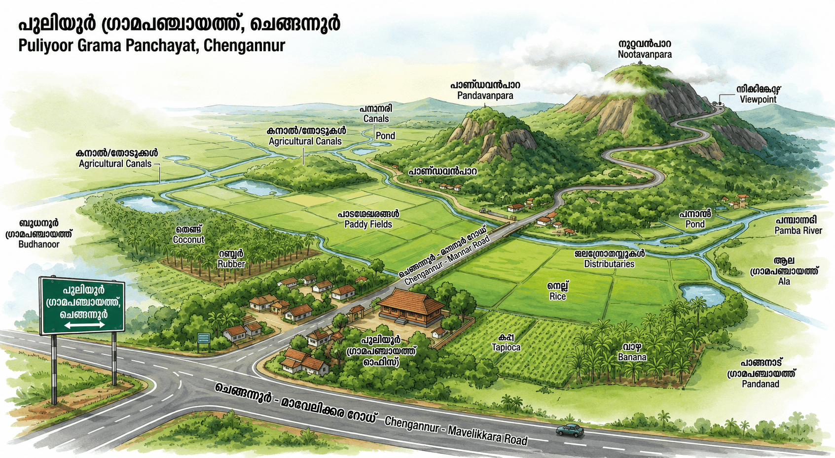
Geography of the Panchayat
Puliyoor Grama Panchayat is a beautiful rural area located in the Chengannur Taluk of Alappuzha district. This area comes under the Chengannur Block Panchayat. The main geographical features of Puliyoor are as follows:
Location and Boundaries
District/Taluk: Puliyoor is situated in the Chengannur Taluk of Alappuzha district. It lies adjacent to the Chengannur Municipality.
Neighboring Villages/Panchayats: Local self-governing territories such as Budhanur, Cheriyanad, Ala, Pandalam, and Pandanad share their boundaries with Puliyoor.
Topography
Geographical Terrain: Part of Central Travancore, Puliyoor possesses a diverse topography consisting of plains, small hillocks, and paddy fields. Although several parts of this region were like isolated islands in the past, today they are completely interconnected by roads.
Elevated Area: The highest hillock in Puliyoor village is known as 'Nootavanpara'. This is also the name of the 4th ward of the Panchayat. Additionally, the mythologically significant 'Pandavanpara' is located in close proximity to it.
Water Sources
The geographical prosperity of this region is enhanced by streams, ponds, and low-lying paddy fields that carry water to its agricultural lands. Tributaries of the nearby Pamba River and other water bodies help maintain the groundwater level in this area.
Climate and Agriculture
Climate: This region experiences the typical tropical climate of Kerala. It receives heavy rainfall from both the South-West Monsoon (Edavappathy) and the North-East Monsoon (Thulavarsham).
Soil and Agriculture: Due to its fertile soil, the land is highly suitable for agriculture. Coconut, rubber, cassava (tapioca), paddy, and banana are the major crops cultivated here. In addition, vegetable farming is also widely practiced.
Major transportation routes, including the Chengannur - Mannar Road, pass through this Panchayat.